
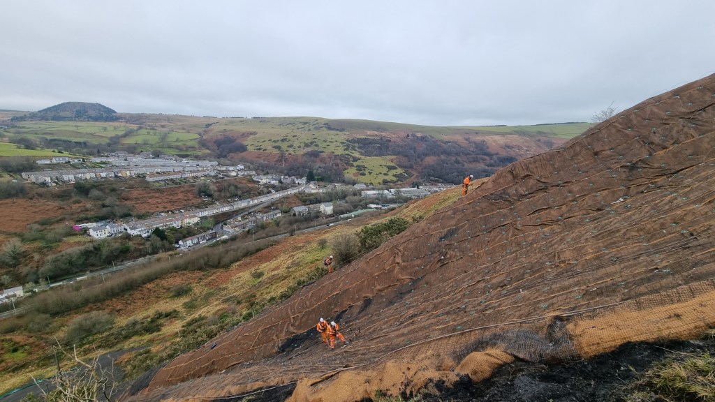
On the last day of the summer term in 2019, the children of Godre’rgraig Primary School came back from a school trip to find television crews outside and a letter waiting for them. Their school was closing — immediately.
The reason was the risk of a landslide. A disused tip on the hillside above the school, left over from an old quarry, had been identified by engineers as a potential danger.
The pupils never went back. They were moved into temporary classrooms in Pontardawe. More than six years later, they remain there. The school building itself was later demolished.

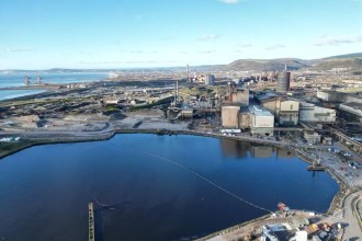
In Wales, few things are taken more seriously than a tip above a school. In 1966, a colliery waste tip above Aberfan — around 30 miles from Godre’rgraig — slid down the mountainside onto Pantglas Junior School, killing 116 children and 28 adults.
That disaster still shapes how tip safety is treated across the south Wales valleys. The Aberfan tip was made of colliery (coal) spoil; the tip above Godre’rgraig is recorded as sandstone quarry spoil — a different material — but the instinct to act fast when a school sits below a hillside tip runs deep.
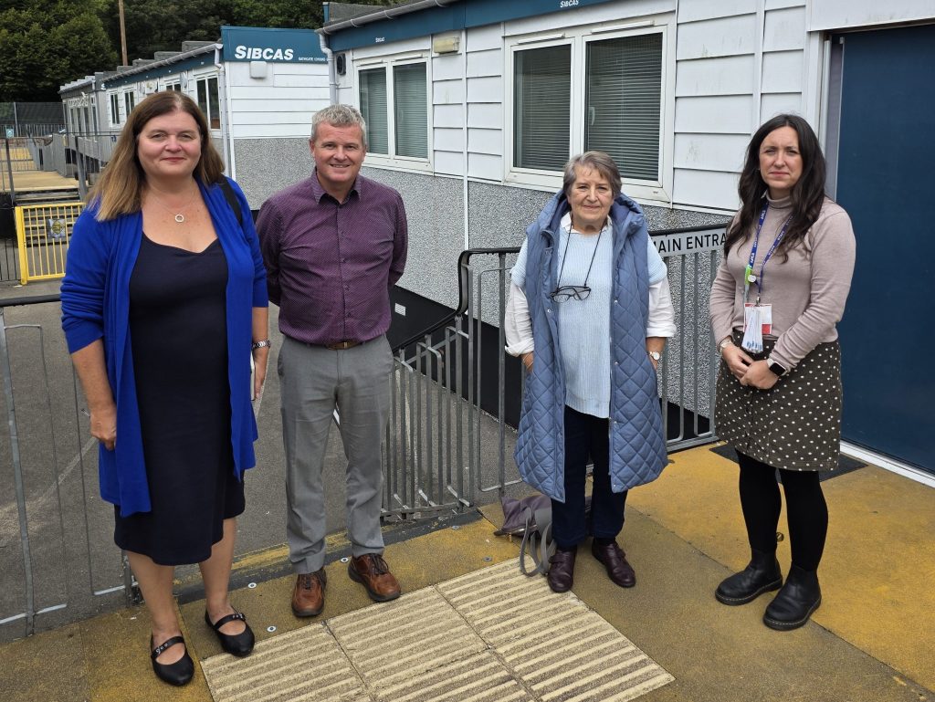
Now a campaign group, Save Our Schools, has been asking detailed questions about how the Godre’rgraig tip was recorded and classified over the years — and Neath Port Talbot Council has responded to a series of those questions put to it by Swansea Bay News.
It is important to separate two things at the outset.
The first is whether there was a genuine danger to the school. On that, the engineering reports the council has pointed to are clear.
The consultancy Earth Science Partnership, which assessed the site, rated the risk of a landslide hitting the school as “medium” in 2019, requiring action to reduce it.
Later work found the quarry spoil tip to be “marginally stable” — below the standard expected for modern engineering “given the high risk to life if failure were to occur”.
By 2024, the firm’s most recent assessment recorded “clear ground movement towards the school”, and said the tip “may be Actively Unstable”, with monitoring instruments detecting continuous or intermittent movement.
The tip has since been given the Welsh Government’s interim “Category D” rating — a tip with the potential to impact public safety, inspected at least twice a year.
So the documented concern about the site is real, and the reports do not suggest the school could simply have stayed open.
The campaign group’s questions are about something different: how the tip’s official boundary and classification were recorded, and whether that information featured fully in years of council decisions.
At the centre is a boundary — the line on the national tip register that defines how much of the hillside the tip covers.
The campaigners say that in 2021 the tip was recorded on the national register as a much smaller, quarry-confined area than the wider hillside footprint shown in earlier mapping — and that this smaller boundary has not been altered since.
Yet they argue this smaller recorded boundary then “was absent” from the council’s subsequent decision-making, including the December 2022 cabinet decision that approved the school’s demolition, which they say referred to the larger area.
Why does the size of the recorded boundary matter? Not, on the evidence of the engineers’ reports, because it changes the danger to the school — that risk comes from the spoil directly upslope, whichever way the boundary is drawn.
But how a tip is recorded and classified does affect which official safety regime and funding it falls under. Neath Port Talbot has secured £3.6m to inspect and maintain more than 620 former tips — and the council’s own correspondence in 2021 noted that quarry spoil tips fell outside certain grant funding available for coal tips.
And it goes to a question of transparency: whether councillors and residents were working from the most up-to-date official record when key decisions were taken. That is the heart of what the campaigners are asking.
When Swansea Bay News reported in May that the council had launched a public coal-tip information hub, the council said the Welsh Government would revise the tip’s boundary this autumn.
The campaigners asked what that revision actually represented, if a smaller boundary had already been recorded in 2021.
In its response, the council said the autumn revision is the formal recording of the boundary established by Earth Science Partnership in 2021, and confirmed it formally asked the Welsh Government to update the map for the site, known as L44A, in October 2025.
On the 2021 submission, the council said the original boundary it sent to the Welsh Government was for a single tip area, called L44, which the government later split into four separate tips — part of an “ongoing process” of defining the boundaries of more than 2,500 tips across Wales.
It pointed to a caveat on the map data stating that tip boundaries are based on a data-capture method and that “100% accuracy cannot be guaranteed”.
Asked how the 2021 boundary informed decisions up to the demolition, the council was direct. “The boundary used in all council decisions was based on the boundary that was established by Earth Science Partnership in 2021 following their onsite investigation works,” it said, “and the WG map is due to be updated in Autumn 2026 to reflect this.”
The campaign group has also questioned how the tip was classified. The distinction between coal spoil and sandstone quarry spoil matters because the two are treated differently under the landmark coal tip safety law that came into force in Wales last year, paving the way for a dedicated authority to manage disused tips.
The campaigners point to a Welsh Government email from September 2022 which, they say, asked the council to provide reports to support changing the site — and two others — from sandstone to coal, noting the tips could not enter the coal-tip regime “without adequate evidence that they are coal”. They say the Welsh Government later confirmed it held no record of that evidence being supplied.
Asked about the reclassification request, the council did not directly confirm the exchange. It said the matter was part of an “ongoing process” of defining tip boundaries, and that the Welsh Government “were shown extracts during a meeting from the Earth Science Partnership Report (which were made public) in 2021”. The council added that “these reports show the presence of both Coal and Quarry spoil in the make up of the Spoil Tip”.
On the campaigners’ broader concerns about transparency, the council said the consultancy’s reports dating back to August 2019 have been publicly available on its website, and that officers and the firm have answered “numerous questions” about their contents.
The questions sit within a longer, painful saga for the community.
A plan to merge Godre’rgraig with two other schools into a single site in Pontardawe was rejected in 2023 after a High Court ruling found the council had failed to properly assess the impact on Welsh-medium education.
Pupils have remained in temporary classrooms throughout. Last year, the First Minister was accused by Plaid Cymru’s Sioned Williams of giving a “shameful” answer over the long wait for a replacement school.
The most recent national data has, if anything, moved the site towards greater caution: last autumn, new figures reclassified three tips at Godre’rgraig to Category D, the highest risk level.
For the campaigners, the central question remains why — if a smaller boundary was recorded nationally in 2021 — the wider hillside interpretation continued to feature in decisions for years afterwards.
The council’s position is that the working boundary throughout was the 2021 Earth Science Partnership assessment, with the national map now set to be formally updated this autumn.
Swansea Bay News will continue to follow the story.