
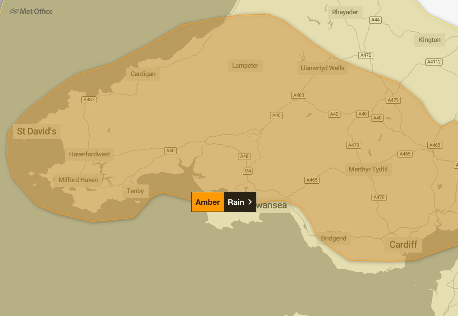
South Wales is braced for a day of disruption on Monday, 1 December, as the Met Office’s amber warning for rain has been upgraded and extended, with Natural Resources Wales (NRW) warning of flooding, landslides and travel chaos.
The warning, in force from midnight until 11.59pm, now stretches north into Ceredigion while some southern coastal areas have been removed. It covers Swansea, Carmarthenshire, Neath Port Talbot, Cardiff, Bridgend, Rhondda Cynon Taf, Pembrokeshire, Powys and more, with the rest of Wales under a yellow warning.
Rivers already swollen
NRW says rivers are already high and the ground saturated, meaning flood alerts and warnings are expected from Sunday evening into Monday morning. Surface water flooding is also likely, particularly in urban and low‑lying areas.
Richard Preece, NRW’s Duty Tactical Manager, said:
“The Amber and Yellow rain warnings in place from the early hours of Monday are expected to bring significant impacts across Wales. With rivers already swollen and the ground saturated, we expect to see a number of flood alerts and warnings issued, with flood warnings indicating flooding is expected.”
Up to 120mm of rain forecast
The Met Office says rainfall totals could reach 100–120mm over higher ground, with 60–80mm likely across hills and 20–40mm in lower areas. Fast‑flowing or deep floodwater is possible, posing a danger to life.
Chief Forecaster Rebekah Hicks said:
“Heavy rain will move over south Wales from late Sunday and through Monday. Whilst rainfall amounts will vary, the largest accumulations are expected over the highest ground in south Wales.”
Landslide risk
The British Geological Survey has warned that rainfall of this magnitude has previously triggered landslides in Wales, with natural and infrastructure slopes at risk. Roads and railways could be disrupted, particularly in areas with long diversion routes.
Advice to residents
NRW is urging people to:
- Move vehicles and valuables to higher ground
- Prepare a flood kit with documents, medication and essentials
- Avoid walking or driving through floodwater
- Check local alerts via naturalresources.wales/flooding or call Floodline on 0345 988 1188
Flood alerts and warnings are updated every 15 minutes. NRW teams are working with the Flood Forecasting Centre, emergency responders and local authorities to monitor conditions and issue updates.
Beyond Monday, forecasters expect a changeable week, with low pressure bringing a mix of rain, showers and occasional sunny spells.