



The whole of south west Wales is under a yellow thunderstorm warning for most of Thursday, with the Met Office warning of torrential downpours, lightning and hail between 5am and 10pm.
The warning takes in all of Swansea, Neath Port Talbot, Carmarthenshire and Pembrokeshire, along with the rest of south and mid Wales.
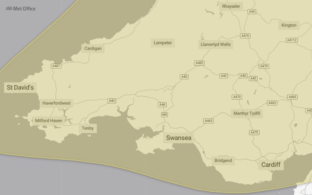
Forecasters say a broad band of thunderstorms and heavy rain will move north across England and Wales during the day, and could become slow moving through the afternoon and evening.
Where the heaviest storms sit, 20 to 30mm of rain could fall in an hour, the Met Office says, with 30 to 40mm expected fairly widely and up to 50mm in 12 hours in places.
There is a small chance some spots see more than 50mm in three hours and over 75mm through 12 hours, especially over east-facing high ground. Hail of 1 to 2cm and lightning are also hazards.
Rain on ground baked dry by the driest of summers
The downpours arrive on land left parched by weeks of drought, which is part of what makes flash flooding the headline risk: the Met Office says flooding of homes and businesses could happen quickly, with damage to buildings from floodwater or lightning strikes.
Fire crews were still on the ground this week tackling wildfire hotspots after a month the fire service called unprecedented.
Spray and standing water could make driving difficult, with some road closures possible, and there is a chance of delays and cancellations to trains and buses where flooding or lightning strikes occur.
Some communities could be cut off if roads flood, and power cuts are possible.
What the Met Office says you should do
Anyone at risk of flash flooding is advised to consider a flood plan and an emergency kit, while drivers should check road conditions before setting out and public transport users should check timetables.
The forecaster also suggests preparing for possible power cuts with torches, batteries and a charged phone power pack.
Anyone caught outside when thunder starts should find enclosed shelter such as a car, stay away from trees and anything else that could be struck, and move off high ground.
As in June, the Met Office is clear that many places will miss the worst: the warning carries a low likelihood but medium impact, meaning the storms may pass some areas by entirely but could hit hard where they land.
It is the sharpest turn in the weather since thunderstorms broke the record June heat. Warnings can change quickly, and the full details are on the Met Office website.

Discover more from Swansea Bay News
Subscribe to get the latest posts sent to your email.